Cole Mill and Bobbitt’s Hole Trails
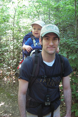
A beautiful hike to one of the nicest areas of the Eno…
Entrances:
As these trails are part of the Eastern Eno trails, we have discussed directions to the entrance in our previous posting about this area. This google map marks the location to the eastern trail parking.
Environment:
Cole Mill Trail and Bobbitt’s Hole Trail are connecting loops. (For reference, Bobbitt’s Hole trail is also known as Bobbit’s or Bobbit Hole Trails.) Cole Mill has two trailheads at the parking lot, and Bobbitt’s Hole Trail is a gem of an extension that allows the hiker to experience Bobbitt’s Hole itself.

Once on Cole Mill Trail, stay to the right. This will get the steep challenging climbing part of the hike over when the legs are fresh. Total climb over the entire hike is about 250 ft. Interesting stone types are seen during the climb and in washed away areas of the trail. Several bridges cross small creeks. 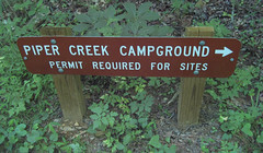 After the first powercut, the Cole Mill Loop/Bobbitt’s Hole fork is present. After the second powercut, the Piper Creek campgrounds with a latrine are passed. A tenth of a mile after the campgrounds, the small spur trail to Bobbit’s Hole can be found.
Bobbitt’s Hole was evidently named for a man named Bobbitt who drowned here. This history does not prevent people from enjoying rock climbing and sun-absorbing in this area. Benches and flat areas for picnics make this area a wonderful resting place. 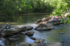 The spur continues a way up the river although evidently it runs into private land. Paths into other private land areas branch away from this spur as well.
The rest of the trail follows the river downstream. Beaver slides near the river are evident. At the powercut, the Cole Mill Loop (from the previously described fork) rejoins this trail. We happened upon a nice park ranger near some fencing near the river. He informed us that the fencing is being used to divert people from using a few areas of older trails near the river that have started to wash. 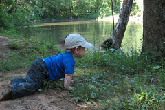 He also brought to our attention that several trees have small metal cages surrounding them to protect them from the hungry beavers in the area.
The trail finishes up near the trailhead for Pea Creek.
Kid’s Interests:
- Interesting rocks on the climb
- Exploring the campgrounds
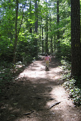
- Bobbit’s Hole
- Bridges
- Looking for beavers and water fowl
Details:
Cole Mill Trail:
- Difficulty: Moderate, shaded
- Surface: Natural
- Bicycles: No
- Length: 1.2 miles
- Blazes: Yellow dots
Bobbitt’s Hole Trail:
Maps and Links:
- Google Maps/Earth: Cole Mill and Bobbitt’s Hole Trails
- Cole Mill and Bobbitt’s Hole Trails KMZ file
- Eno River Association Description of Eastern Trails
- PDF map of Eastern Trails
Photos:
Flickr Photos from Cole Mill and Bobbit’s Hole Trails (35)


